Chicago boating conditions: 5 Essential Tips for Safe Sailing
Why Chicago Boating Conditions Matter Before You Cast Off
Chicago boating conditions are essential to check before every outing on Lake Michigan. Here’s what you need to know right now:
Quick Check: Today’s Key Conditions
- Wind Speed & Direction: Check for speeds under 25 knots; higher means Small Craft Advisory
- Wave Height: Safe boating typically under 3-4 feet for smaller vessels
- Active Advisories: Small Craft Advisory, Gale Warning, or Storm Warning in effect?
- Water Temperature: Currently ranges from freezing (winter) to 70°F+ (summer)
- Visibility: Fog and storms can reduce visibility to dangerous levels
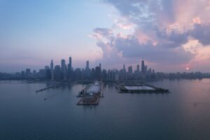
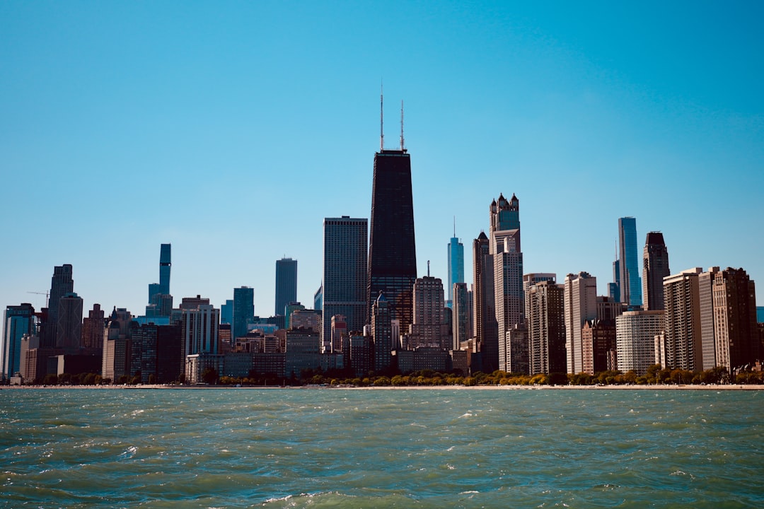
Lake Michigan’s beauty is matched only by its unpredictability. One moment you’re cruising in calm waters with the Chicago skyline gleaming in the distance, and the next, winds can shift, waves can build, and what seemed like a perfect day turns challenging fast. Understanding Chicago boating conditions isn’t just about comfort—it’s about safety, smart planning, and making the most of every moment on the water.
Whether you’re planning a sun-soaked afternoon at the Playpen, a river cruise through downtown, or an extended voyage along the shoreline, knowing how to read and interpret marine forecasts is your first line of defense. The National Weather Service provides detailed forecasts, buoys deliver real-time data, and seasonal patterns help you anticipate what’s ahead.
I’m Heidi Auvenshine, Partnership and Marketing Director for Playpen Chicago, and I’ve spent years helping boaters, charter guests, and waterfront enthusiasts steer Chicago boating conditions on Lake Michigan. Through on-the-water experience and close collaboration with local operators, I’ve learned that preparation makes all the difference between a memorable outing and a risky situation.

Decoding the Marine Forecast: Key Metrics for Chicago Boaters
For anyone venturing onto Lake Michigan, understanding the marine forecast is paramount. The National Weather Service (NWS) and National Oceanic and Atmospheric Administration (NOAA) are our primary sources for marine weather information, offering detailed insights into the complex interplay of wind, waves, and weather phenomena. Our philosophy is always safety first, and that starts with knowing what the lake has in store.
Understanding Wind Speed and Direction
Wind is arguably the most critical factor influencing Chicago boating conditions. It dictates wave height, impacts your vessel’s handling, and can quickly turn a pleasant day into a perilous one. Marine forecasts typically report wind speed in knots (kt), where one knot is approximately 1.15 miles per hour (MPH). So, a forecast of 10 kt means winds around 11.5 MPH.
The direction of the wind is equally important. On Lake Michigan, prevailing winds are generally from the south-southwest, but shifts can occur rapidly. Wind gusts, often reported alongside sustained wind speeds, indicate sudden, brief increases in wind velocity. For example, a forecast of “West gales to 35 kt” means sustained winds are at gale force, with gusts reaching even higher, adding an extra layer of challenge and danger. Knowing the wind’s direction helps us anticipate wave patterns and plan our route to minimize discomfort and maximize safety. Always be prepared for sudden changes, and remember that strong winds can create dangerous conditions even for experienced boaters. For more tips on staying safe, check out our Boat Safety Key.
Interpreting Wave Height
When we talk about waves on Lake Michigan, we’re primarily concerned with two measurements: significant wave height and occasional waves. Significant wave height refers to the average height of the highest one-third of the waves. This is the number most commonly cited in marine forecasts. However, it’s crucial to also pay attention to the “occasionally to” figure, which represents the average height of the highest 10% of waves. These are the larger, less frequent waves that can catch us off guard and pose a greater risk. For instance, a forecast of “Waves to 4 ft building to 4 to 6 ft occasionally to 8 ft” means you’ll consistently encounter waves between 4 to 6 feet, but every now and then, a wave as high as 8 feet might roll through.
The “fetch” is another critical concept. This refers to the distance over open water that wind can blow uninterruptedly in a constant direction. On Lake Michigan, a long fetch can quickly build significant wave heights, especially with strong winds from the north or south, which have a long stretch of lake to pick up speed and generate larger waves. Even if the wind isn’t directly offshore from Chicago, a strong wind blowing down the length of the lake can create formidable conditions.
Weather Alerts and Advisories You Can’t Ignore
The NWS issues specific marine weather alerts to warn boaters of hazardous conditions. These are not just suggestions; they are serious warnings that we must heed for our safety and the safety of our passengers.
- Small Craft Advisory: This is issued when sustained winds or frequent gusts are forecast to be between 25 and 33 knots (29-38 MPH) and/or dangerous wave conditions (typically 4 feet or higher) are expected. For example, a recent advisory warned of “Northwest winds to 25 kt and significant waves to 6 ft occasionally to 8 ft.” If you see a Small Craft Advisory, it’s a strong recommendation for smaller vessels to stay in port or exercise extreme caution. Light rain, passing storms, and cooler temperatures are usually considered charterable, but a Small Craft Advisory often means conditions are uncharterable.
- Gale Warning: A more severe alert, a Gale Warning is issued for sustained winds or frequent gusts from 34 to 47 knots (39-54 MPH). We’ve seen forecasts like “Gale Warning in effect from Thursday evening through late Thursday night” with “West gales to 35 kt.” These conditions are extremely dangerous for all but the largest and most robust vessels.
- Storm Warning: The highest level of wind warning, a Storm Warning indicates sustained winds or frequent gusts of 48 knots (55 MPH) or greater. These are extremely rare on Lake Michigan but demand immediate action to seek safe harbor.
Always check for active alerts before and during your outing. You can easily Check for active alerts here. These advisories are issued for entire zones, so even if a point forecast looks benign, the broader zone advisory could indicate danger for your area.
Your Go-To Resources for Real-Time Chicago Boating Conditions
In our experience, relying on a single source for weather information is never enough, especially on a body of water as dynamic as Lake Michigan. We always recommend consulting multiple sources, both official and commercial, to get a comprehensive picture of current and forecasted Chicago boating conditions. Real-time data is our best friend, offering immediate insights that can confirm or contradict forecasts.
Official NWS and NOAA Forecasts
The National Weather Service (NWS) and National Oceanic and Atmospheric Administration (NOAA) are the gold standard for marine weather. Their forecasts are carefully crafted by meteorologists who understand the unique dynamics of the Great Lakes.
- Nearshore Marine Forecast: This forecast covers the waters within five nautical miles of the shoreline, which is where most recreational boating in Chicago takes place. It provides detailed information on wind, waves, and precipitation for specific zones, such as “Wilmette Harbor to Northerly Island IL” or “Northerly Island to Calumet Harbor IL.” We can access this in text format or through interactive graphical forecasts.
- Open Waters Forecast: For those venturing further offshore, the Open Waters Forecast provides conditions for the deeper parts of Lake Michigan.
- Graphical Forecasts: These interactive maps allow us to click on a specific point to get a detailed point forecast, including hourly weather graphs for wind, waves, and precipitation. This visual representation can be incredibly helpful for planning. Access the NWS Graphical Forecast to explore this valuable tool.
- Hourly Weather Graphs: These provide a granular view of how conditions are expected to change hour-by-hour, perfect for fine-tuning departure and return times.
- Chicago Area Forecast Discussion: For those who want to dive deep, the Forecast Discussion offers meteorologists’ detailed analysis and reasoning behind the forecast, providing context to the numbers.
Live Data from Buoys and Weather Stations
While forecasts predict the future, buoys and weather stations tell us what’s happening right now. These real-time observations are invaluable for confirming current Chicago boating conditions and detecting rapid changes.

Several key buoys and weather stations provide crucial data for Chicago boaters:
- Harrison-Dever Crib (CHII2): Located near Chicago, this station provides real-time wind direction, speed, and gusts, as well as air temperature. A recent observation showed a Wind Direction: NW (320°), Wind Speed: 18 knots, Wind Gust: 20 knots, and Air Temperature: 32°F (0.1°C). This is a great resource for conditions right outside the harbor.
- Wilmette Buoy (45174): To our north, the Wilmette Buoy offers similar data, giving us a good sense of conditions up the coast.
- Chicago Buoy (45198): This buoy, further offshore, is a critical source for open water conditions near Chicago. View live data from the Chicago Buoy to get the latest readings.
These buoys report data like wind speed and direction, wave height, and sometimes water temperature. Integrating this live data with official forecasts allows us to make the most informed decisions.
Water Temperature and Lake Levels
Beyond wind and waves, water temperature and lake levels are vital aspects of Chicago boating conditions that impact both safety and navigation.
- Water Temperature: Lake Michigan’s water temperature varies dramatically throughout the year. While summer months can see comfortable swimming temperatures (often reaching 70°F+), spring and fall can be dangerously cold. Even in summer, deeper waters remain frigid. Cold water immersion can quickly lead to hypothermia, making appropriate gear and caution essential, especially if we plan to swim or if there’s a risk of falling overboard. For specific insights into swimming safety, particularly at the Playpen, refer to our guide: Is it safe to swim at the Playpen?.
- Lake Levels: The Great Lakes, including Lake Michigan, experience natural fluctuations in water levels, both seasonally and over longer cycles. These changes can affect navigation, particularly in shallow areas, harbor entrances, and when docking. The U.S. Army Corps of Engineers provides forecasts for lake levels across the Great Lakes, which we regularly monitor. While generally not a daily concern for open water boating, it’s crucial for understanding long-term trends and potential impacts on marina access and shoreline activities.
A Seasonal Guide to Boating in Chicago
Chicago offers a distinct boating experience throughout the year, each season presenting its own unique Chicago boating conditions and charms. Understanding these patterns helps us plan our outings and appreciate the lake in all its moods.
Spring (April-May): The Awakening
As the ice recedes and temperatures slowly climb, spring marks the awakening of the boating season. Chicago boating conditions in spring are characterized by chilly water, often still in the 40s or 50s, making cold water immersion a significant hazard. Air temperatures can be quite unpredictable, swinging from mild, sunny days to cold, blustery ones. We often see fewer crowds during this time, offering a peaceful experience for those willing to bundle up. It’s an excellent time for preparing our vessels for the busier months ahead and enjoying the quiet beauty of the lake before the summer rush.
Summer (June-August): Peak Boating Season
Summer is undeniably the peak boating season in Chicago. Air temperatures are warm, with July averaging an 84°F high, though we can experience about 18 days each year exceeding 90°F. Water temperatures become more inviting, especially in shallower nearshore areas and the Playpen, often reaching above 70°F. The lake is busy with activity, from yachts at the Playpen to sailboats racing along the shore.
However, summer also brings its challenges. Thunderstorms are common, with Chicago averaging 37 thunderstorm days per year. These storms can develop quickly, bringing sudden strong winds, heavy rain, and lightning. We must be vigilant in monitoring radar and forecasts. This is also when many popular events take place, like fireworks cruises and raft-ups. For more information on what’s happening, check out Chicago Summer Events 2025.
Fall (September-October): Crisp Air and Clear Views
Fall offers some of the most spectacular Chicago boating conditions. The air is crisp, the crowds thin out, and the city skyline often appears with stunning clarity. Daytime temperatures are cooler, but still pleasant, with highs in the 50s and 60s not uncommon. However, strong winds can become more frequent, particularly as cold fronts move through. The water temperature begins to drop, again raising the risk of hypothermia for anyone unexpectedly entering the water. Fall is a fantastic time for a leisurely cruise, enjoying the changing colors along the shoreline, and preparing our boats for winter storage.
Winter (November-March): For the Hardy Few
Winter transforms Lake Michigan into a formidable, icy expanse. Chicago boating conditions during these months are extreme, with air temperatures averaging a high of 29°F in January and lows of 14°F. Ice formation is extensive, and freezing spray can pose a significant hazard to any vessel operating in open water. While recreational boating is largely put on hold, commercial traffic continues, navigating the challenging conditions. The lake is beautiful in its winter solitude, but it demands respect and extreme caution from anyone venturing out. Chicago experiences an average of 68 days of snow each year, totaling about 38 inches, further emphasizing the harsh winter reality on the lake.
From Harbor to Horizon: Applying the Forecast
Understanding the forecast is one thing; applying it effectively to our boating plans is another. Every boater develops a system, but some core principles remain universal for safe and enjoyable experiences on Lake Michigan.

Interpreting the Daily Chicago Boating Conditions
Before we even think about leaving the dock, we engage in a “Go/No-Go” decision-making process. This involves comparing the forecasted Chicago boating conditions with our vessel’s capabilities and our own experience level.
- Matching Conditions to Your Vessel: A small runabout might handle 1-2 foot waves comfortably, but 3-5 feet would be a significant challenge. A larger yacht, however, might barely notice those conditions. We must be realistic about what our boat (and we) can safely handle.
- Filing a Float Plan: Always tell someone ashore your planned route, expected return time, and who is on board. This simple step is crucial for safety and can make all the difference in an emergency.
- Trust Your Gut: As one expert puts it, “if your gut feels it’d be dangerous to leave the dock, it probably is, so trust it and appreciate land for what it offers—you can always go boating tomorrow.” We couldn’t agree more. If conditions feel off, it’s always better to err on the side of caution.
Navigating Key Chicago Locations
Specific areas in Chicago have unique characteristics that influence how we interpret and apply the marine forecast.
- The Chicago Playpen: This popular recreational area, often busy with activity, is located just offshore from Oak Street Beach. While generally protected from the largest waves by the shoreline and breakwaters, strong winds from certain directions can still create choppy conditions. Understanding the nearshore forecast for the “Wilmette Harbor to Northerly Island IL” zone is particularly relevant here.
- Chicago River Lock System: For those wanting to transition from Lake Michigan into the Chicago River, navigating the Chicago Harbor Lock system is a unique experience. We need to be aware that traveling through the locks can take up to an hour each way on high-traffic days, significantly impacting our charter time. This is an important consideration when planning a river cruise. Learn about the Chicago Harbor Lock.
- Harbor Entrances: Entering and exiting Chicago’s numerous harbors can be tricky in strong winds and waves, as conditions can be amplified at the mouth of the harbor. Always approach with caution and respect the conditions.
- Anchoring at the Playpen: If we plan to anchor at the Playpen, understanding wind direction and speed is critical for safely setting and weighing anchor. Strong winds can make anchoring difficult and drag possible. We also have specific rules regarding tie-ups and spacing when anchored near other vessels. For detailed guidelines, consult the Anchoring Rules at the Playpen.
Historical Chicago Boating Conditions and What to Expect
Understanding historical weather patterns provides a valuable backdrop for interpreting daily forecasts and planning our boating season.
- Average Temperatures: July is Chicago’s warmest month with an average high of 84°F, while January is the coolest, averaging 29°F. The highest recorded temperature was 104°F, and the lowest a chilling -27°F.
- Precipitation Patterns: Chicago receives an average of 35.25 inches of precipitation annually. August is typically the wettest month (4.10 inches), and February the driest (1.37 inches). While rain can occur any time, summer thunderstorms are a key consideration.
- Windiest Months: Winter through early spring is generally the windiest period in Chicago, with an average wind speed of nine knots. However, strong winds can occur year-round. A maximum gust of 73 knots was recorded in March 1991, reminding us of Lake Michigan’s potential ferocity. The prevailing wind direction is south-southwest.
- Fog: Chicago experiences fog on average 131 days each year, which can drastically reduce visibility and create dangerous navigation conditions.
By combining real-time data, current forecasts, and an understanding of historical patterns, we can develop a robust approach to navigating Chicago boating conditions.
Frequently Asked Questions about Chicago’s Marine Weather
We often get asked common questions about Chicago boating conditions. Here are some of the most frequent inquiries and our expert answers to help you boat smarter and safer.
What is a Small Craft Advisory on Lake Michigan?
A Small Craft Advisory on Lake Michigan is a warning issued by the National Weather Service when conditions are expected to be hazardous to small boats. Generally, this means sustained winds or frequent gusts are forecast to be between 25 and 33 knots (29 to 38 mph), and/or dangerous wave conditions (typically 4 feet or higher) are expected. For example, a recent advisory mentioned “Northwest winds to 25 kt and significant waves to 6 ft occasionally to 8 ft.” This advisory is not a prohibition, but a strong recommendation for smaller, less experienced vessels to remain in port. It’s a signal to exercise extreme caution, and for many, it’s a clear “No-Go” decision.
How quickly can weather change on Lake Michigan?
Lake Michigan is notorious for its rapidly changing weather. The “lake effect” can cause localized weather phenomena, and fast-moving frontal systems can sweep across the lake with little warning. What starts as a calm, sunny morning can quickly turn into a stormy afternoon with high winds and waves. We’ve seen winds shift rapidly, and waves build from 1-3 ft to 6-12 ft in a matter of hours, as indicated in past forecasts. This rapid change highlights the importance of continuous monitoring of radar and forecasts while on the water. Always have an escape plan, know your nearest safe harbor, and be prepared to cut your trip short if conditions deteriorate.
Where can I find the forecast for the Chicago Playpen specifically?
While there isn’t a forecast specifically labeled “Chicago Playpen,” we can get a very accurate picture of conditions by focusing on the nearshore marine forecast zones that cover that area. The Playpen is located within the “Wilmette Harbor to Northerly Island IL” or “Northerly Island to Calumet Harbor IL” nearshore zones.
You can use the NWS point-and-click graphical forecasts, selecting a point directly over the Playpen, to get a localized forecast for wind, waves, and precipitation. Additionally, monitoring real-time observations from the Northerly Island weather station (CNII2) or the Harrison-Dever Crib (CHII2) will give you current conditions in the immediate vicinity. These resources, combined with visual observation from shore or nearby vessels, provide the best assessment for the Playpen. For more details on this popular spot, check out What is Playpen Chicago?.
Conclusion: Boat Smart, Boat Safe
Navigating Lake Michigan’s waters, especially around Chicago, is an unparalleled experience that combines the thrill of boating with the stunning backdrop of our iconic skyline. However, the lake demands respect, and our primary responsibility as boaters is always safety. By consistently checking Chicago boating conditions and understanding what the forecasts and real-time data mean, we empower ourselves to make informed decisions.
Preparation is paramount. Always consult multiple sources, pay close attention to wind, waves, and advisories, and never underestimate the lake’s power. A “Go/No-Go” decision is a personal one, and if your gut tells you to stay ashore, listen to it.
At Playpen Chicago, we’re not just about connecting boaters to incredible experiences; we’re also about fostering a community that prioritizes safety and responsible enjoyment of Lake Michigan. We encourage you to connect with fellow boaters, share insights, and always stay informed. Get the complete Lake Michigan Boating Forecast to plan your next adventure safely and confidently.